


Kings Canyon Rim Walk Map: Route, Key Stops and What You’ll See
TL;DR: The Kings Canyon Rim Walk is a 6km loop that runs one way, clockwise, and takes three to four hours. Four things along the route are worth knowing about before you set off: the opening climb, the Lost City domes, the Cotterills Lookout side trip and the Garden of Eden detour.
Both detours on the Kings Canyon Rim Walk are 600m return. Both add time to a walk that’s already three to four hours in the desert. So the question most people are actually asking when they go looking for a Kings Canyon Rim Walk map is whether those detours are worth it, and what they’ll miss if they skip them.
This is a route preview rather than a difficulty guide. If you want to know how hard the climb is and who should attempt it, that’s covered separately in our blog that explains the difficulty in detail.
The Route at a Glance
| Stop | Roughly from start | What you’ll see |
| Car park and trailhead | 0km | Shade shelter, water tap, the wall you’re about to climb |
| Top of the climb | 0.5km | First views back over the plateau and out to the George Gill Range |
| Cotterills Lookout turn-off | 1.5km | 600m return detour to a lookout over the canyon’s north wall |
| The Lost City | 2km | Beehive-shaped sandstone domes, weathered into rows |
| Garden of Eden turn-off | 3km | 600m return, about 20 minutes, down to a permanent waterhole |
| South wall and the return leg | 4km | The best long views straight across the canyon to where you started |
| Descent to the car park | 5.5km | Switchbacks down the eastern side |
Start Point and Direction
The walk begins and ends at the Kings Canyon car park in Watarrka National Park, which is also where the Kings Creek Walk starts. Look for the Rim Walk signage on the left as you face the canyon.
The loop is one way, clockwise. That isn’t a suggestion. Signage directs everyone the same way, and it exists so people aren’t passing each other on narrow sections and so the steep climb happens on the ascent rather than the descent.
The first 500m is the climb, roughly 500 stone steps, and it takes most people 20 to 30 minutes. That’s the whole difficulty of the walk in one section. Get past it and the rest of the loop is comparatively gentle.
The Top of The Rim
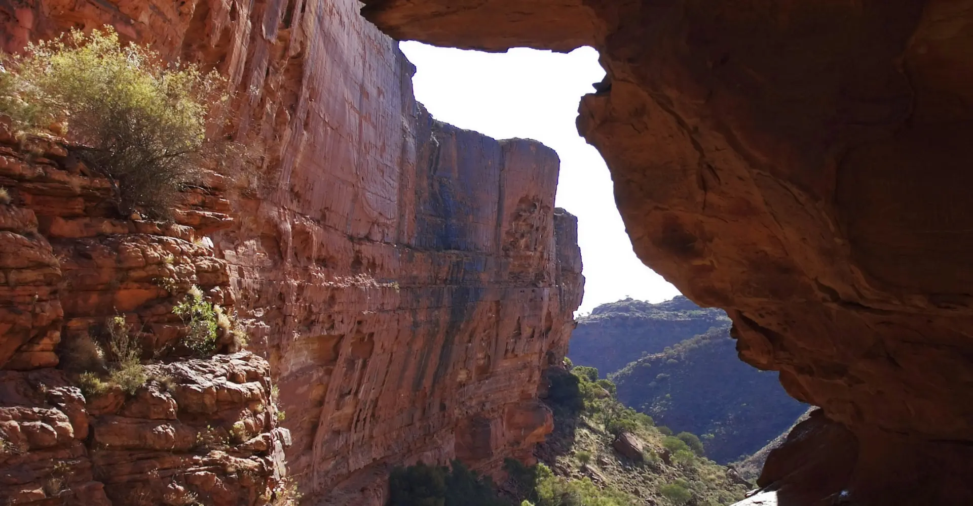
The climb ends without much ceremony. The steps run out, the ground levels off, and you’re standing on a broad sandstone plateau with the canyon opening on your right.
The first proper viewpoints come within a few minutes. From here you’re looking down into the canyon from around 100 metres up, across at the sheer north wall, and out over the George Gill Range in the other direction. On a clear morning you can see a long way, and the light on the red rock at that hour is why guides push people out of bed at 5am.
The path here is marked with poles and cairns rather than being a formed track. You’re walking on the rock itself.
The Lost City
About two kilometres in, the terrain changes completely.
The flat plateau breaks up into hundreds of rounded sandstone domes, spaced out in loose rows with narrow gaps between them. They look built rather than eroded, which is where the name came from. Walking through it feels less like a bushwalk and more like moving through a ruined town.
The domes formed the way most things here did: cross-bedded sandstone laid down as desert dunes hundreds of millions of years ago, then fractured into a grid pattern and rounded off by wind and water working on the joints. The path threads between them for a good stretch of the walk.
This section needs no detour. You walk straight through it.
Cotterills Lookout Detour
The Cotterills Lookout turn-off comes up early, roughly 1.5km in. It’s a 600m return side trip out onto a spur, and it takes about 15 minutes there and back.
Our steer: take it if you’re walking in the first two hours after sunrise, and skip it if you’re running late or already feeling the heat. The lookout gives you a different angle on the canyon’s north wall, looking along it rather than across it, and it’s a quieter spot than the main viewpoints. But it’s a variation on a view you’ll get several more times on the loop, not a different experience.
If you’re deciding between the two detours and only have time for one, take the Garden of Eden.
Garden of Eden detour
This one is the reason people do the walk.
The turn-off is roughly halfway around. It’s 600m return, about 20 minutes, and it drops you down a set of stairs into a narrow gorge cut into the plateau. At the bottom is a permanent waterhole, shaded by rock walls and ringed with cycads and ferns that have been growing there since the region was wetter.
The temperature difference between the rim and the bottom of the Garden of Eden on a hot day is significant. It’s the only genuinely shaded spot on the entire loop.
You can’t swim here. The waterhole is a sacred site to the Luritja people, and it’s also the only reliable water for wildlife for a long way in any direction. Sunscreen, insect repellent and body oils in the water are a real problem for the animals that depend on it. Sit on the rocks, have your snack, and leave it as you found it.
Then it’s back up the stairs on the far side to rejoin the loop.
The Return Leg
The second half of the walk runs along the south wall, and the views are best from here.
You’re now looking back across the canyon at the north wall and at the rim you walked earlier in the morning. The scale reads properly from here in a way it doesn’t when you’re standing on top of it. There are several unmarked spots where the rock forms natural viewing platforms.
A note on those: sections of the rim have no guardrails, and the sandstone can be undercut where you can’t see it. Stay on the marked route and take your photos from where the path puts you.
The final section descends through switchbacks on the eastern side, back down to the car park. It’s easier than the climb but harder on the knees.
Doing It With a Guide
The detours are where self-guided walkers most often get their timing wrong. Take both, linger at the Garden of Eden, and you can find yourself on the exposed south wall at 11am in 35 degree heat with a litre of water left.
If you’d rather not manage the pacing, the water and the early start yourself, you can walk the loop as part of a guided Kings Canyon tour with us. Our guides run the group clockwise on a schedule that puts you at the Garden of Eden while it’s still cool, and they’ll tell you which detour to take based on the day rather than the brochure.
Frequently Asked Questions
Six kilometres, taking three to four hours for most walkers including stops. Both detours add roughly 20 minutes each.
The main features in order are the climb and its first viewpoints, the Cotterills Lookout turn-off, the Lost City sandstone domes, the Garden of Eden waterhole and the south wall views on the return leg.
Yes. It’s the only shaded stop on the walk, the waterhole and cycads are unlike anything else on the loop, and 20 minutes is a small addition to a four hour walk. If you only take one detour, take this one.
About 1.5km in, shortly after the top of the climb, on the northern side of the loop. It’s signposted and the detour is 600m return.
No. The loop is signposted one way, clockwise, and walking it in reverse puts you descending the steep steps and moving against everyone else on narrow sections.
Rows of rounded, beehive-shaped sandstone domes with narrow gaps between them, spread across a section of the plateau. The path runs through the middle of them.
Assume there isn’t. Coverage across Watarrka National Park is patchy at best and you shouldn’t rely on a phone map. The route is well marked with poles and cairns, so follow those.
Other Tips & Articles

Check out our other Uluru Tours


